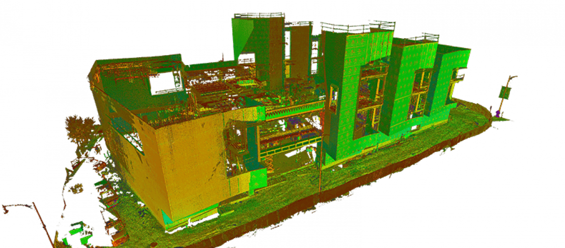
You may have been hearing about LiDAR, light detection and ranging, in the last couple of years or so, as it’s becoming more used in common technology. Do you have a new cell phone? It may have LiDAR built in already. LiDAR is also a key component of some “self-driving” cars. Though LiDAR was first created in the 1960s, it may finally be the “next big thing,” and it is going to turn some heads.
LiDAR is an acronym like RADAR, and like RADAR, LiDAR uses bounced waves to create a map or model of terrain. Where RADAR bounces radio waves off objects and then “assembles” an image of those objects, LiDAR bounces light waves from lasers off of objects. The receiver then receives the bounced light waves and creates a three-dimensional map or image of the site called a point cloud. The point cloud can have millions of data points, each geolocated. It seems like the FBI approach to site analysis; a special machine takes a quick scan of a site and you have it fully mapped in 3D. That’s pretty darn close. Can you see why surveyors are excited about LiDAR?
LiDAR is fundamentally similar to RADAR, but with accuracy in another league, and its use is expanding now in combination with drones. On-site surveyors now operate drones and get far more accurate maps and models faster and cheaper than ever before possible. In addition, drones can easily access terrain that is totally inaccessible by human, helicopter, or airplane.
The potential time- and labor-savings for the survey and site crews are substantial. The LiDAR can map right through vegetation and deliver an accurate site plan, virtually eliminating surprises. The architects and engineers can place the building on the site, then offer the team a virtual-reality walkthrough. It’s like being in the best video game you’ve ever seen.
Much like BIM did a few years ago, LiDAR permits a fully digital representation of the site and the project, making clashes apparent much sooner in the process and therefore much cheaper and easier to correct. LiDAR can also be combined with virtual reality tools for stakeholders, enabling far greater precision in modeling before a bucket of dirt has been moved.
In addition, LiDAR remains useful at all points of the construction cycle. A surveyor can perform inspections at any time to see if as-built conforms with plans, with no need for a crane or lift—or danger to a worker, or a permit, and so on. Many dangerous tasks can be handled with drone and LiDAR. There’s simply no need to risk a worker on that task, and the result is better than the old way.
Like laser levels, CAD, and BIM before, LiDAR is a new tool that improves work immeasurably and is really just getting started. Have you started using LiDAR yet?
